  Analysis Flooding hits new construction at North Korea’s Sohae spaceport: ImageryState media reports over 4 inches of rain in region Sunday that may have disrupted work on construction camp, warehouse 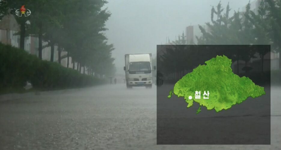 Heavy rains and flooding appeared to disrupt a recently started project to upgrade North Korea’s Sohae spaceport, according to NK Pro analysis of satellite imagery. Planet Labs imagery taken on Aug. 8 shows signs of landslides and water inundating the Sohae Satellite Launching Ground’s railroad tracks, a new trackside warehouse and the project’s construction worker camp, possibly leading to cleanup efforts and project delays. The imagery shows slight progress on the upgrade project in the weeks prior to the flooding. North Korean leader Kim Jong Un announced plans to build a range of new facilities at Sohae in March, and NK Pro was the first to report last month on initial signs that construction is underway.  The severity of the flooding is unknown and state media has not reported any damage at the site, but Korean Central Television (KCTV) said North Phyongan Province, where Cholsan County and the Sohae complex are located, received 4.2 inches (107 mm) of rain on Sunday, the most in the country that day. Two of the new project’s initial tasks appear to have been to build a construction worker camp east of Sohae and connect it to the launch facilities via a new mountain path, and to build a new warehouse along the railroad tracks just outside the complex’s main entrance. Both of these areas appear to have been flooded, according to Planet Labs imagery. The imagery shows the railroad track underwater in multiple places, and the small patch of land surrounding the new but unfinished warehouse — located between the tracks and main road heading into Sohae and detailed in a recent Center for Strategic and International Studies report — was completely submerged on Monday morning. 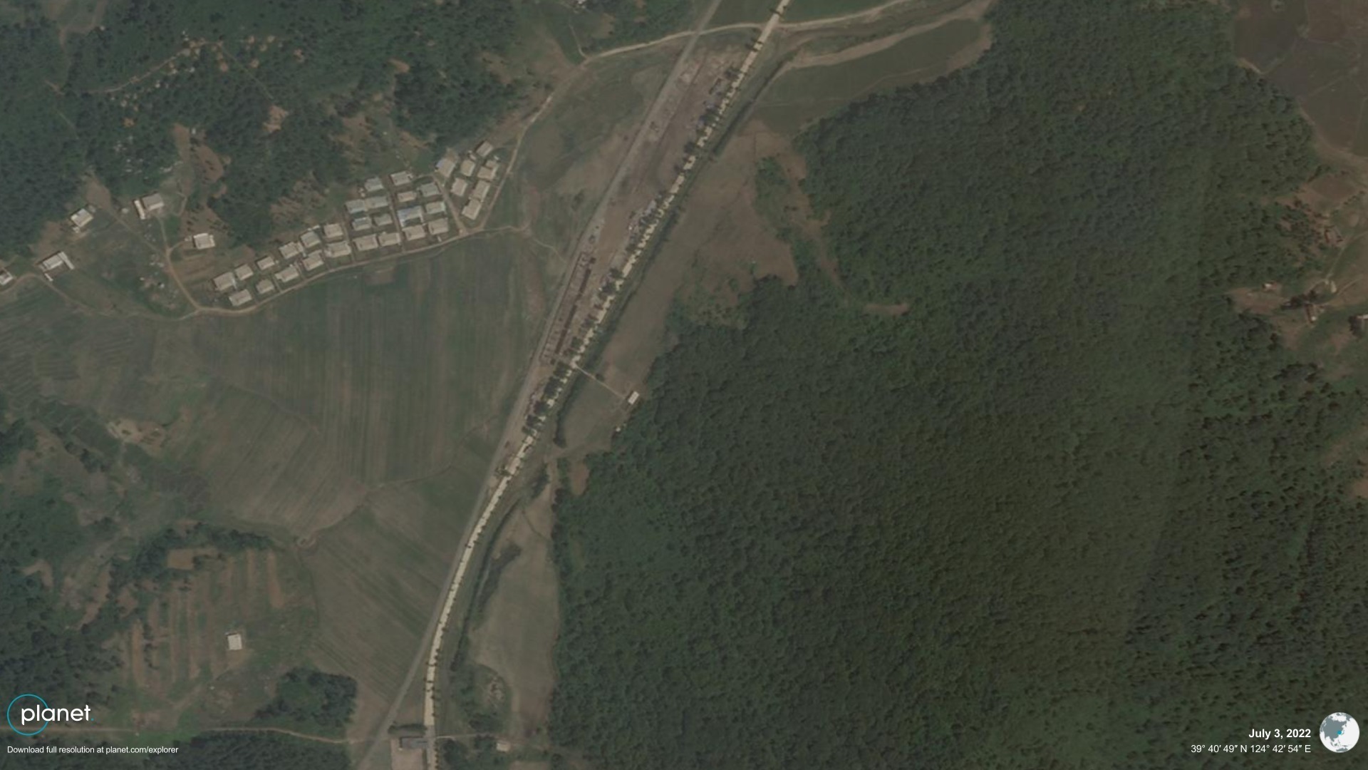 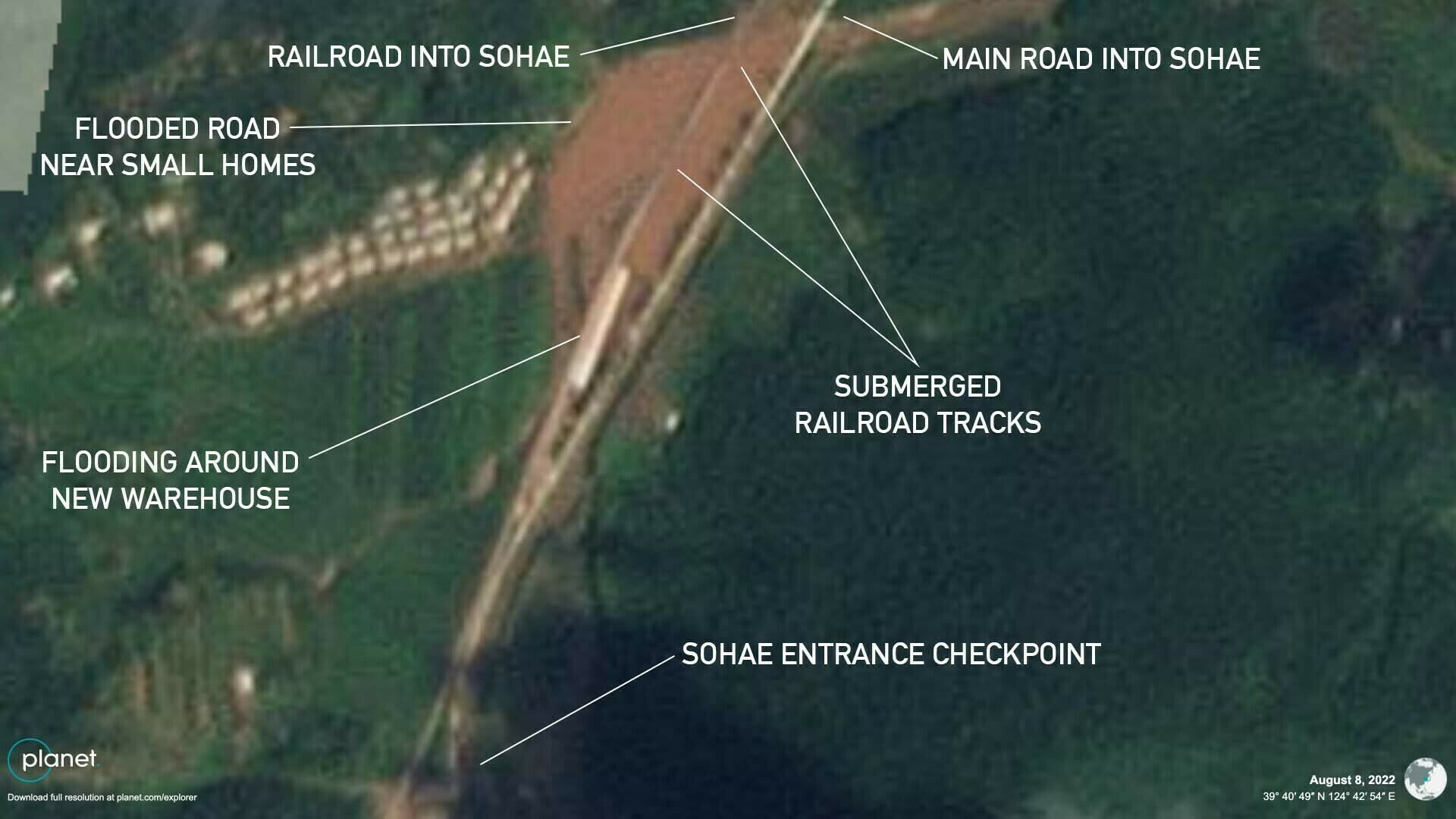 A close-up look on Aug. 8 at the flooded rail section and new warehouse just to the north of the Sohae complex entrance, compared with a high-resolution shot of the warehouse under construction taken on July 3 (coordinates: 39.680573°, 124.713894°) | Images: Planet Labs PBH, edited by NK Pro 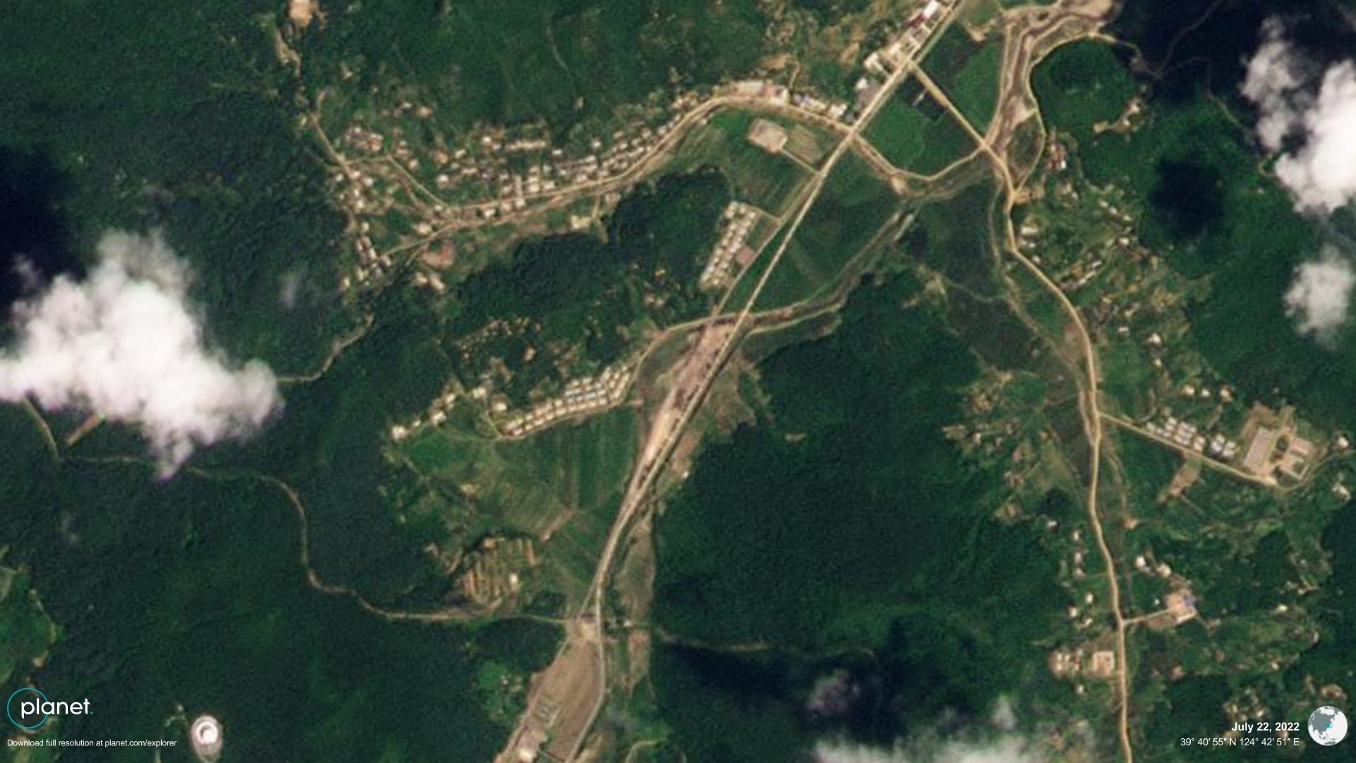 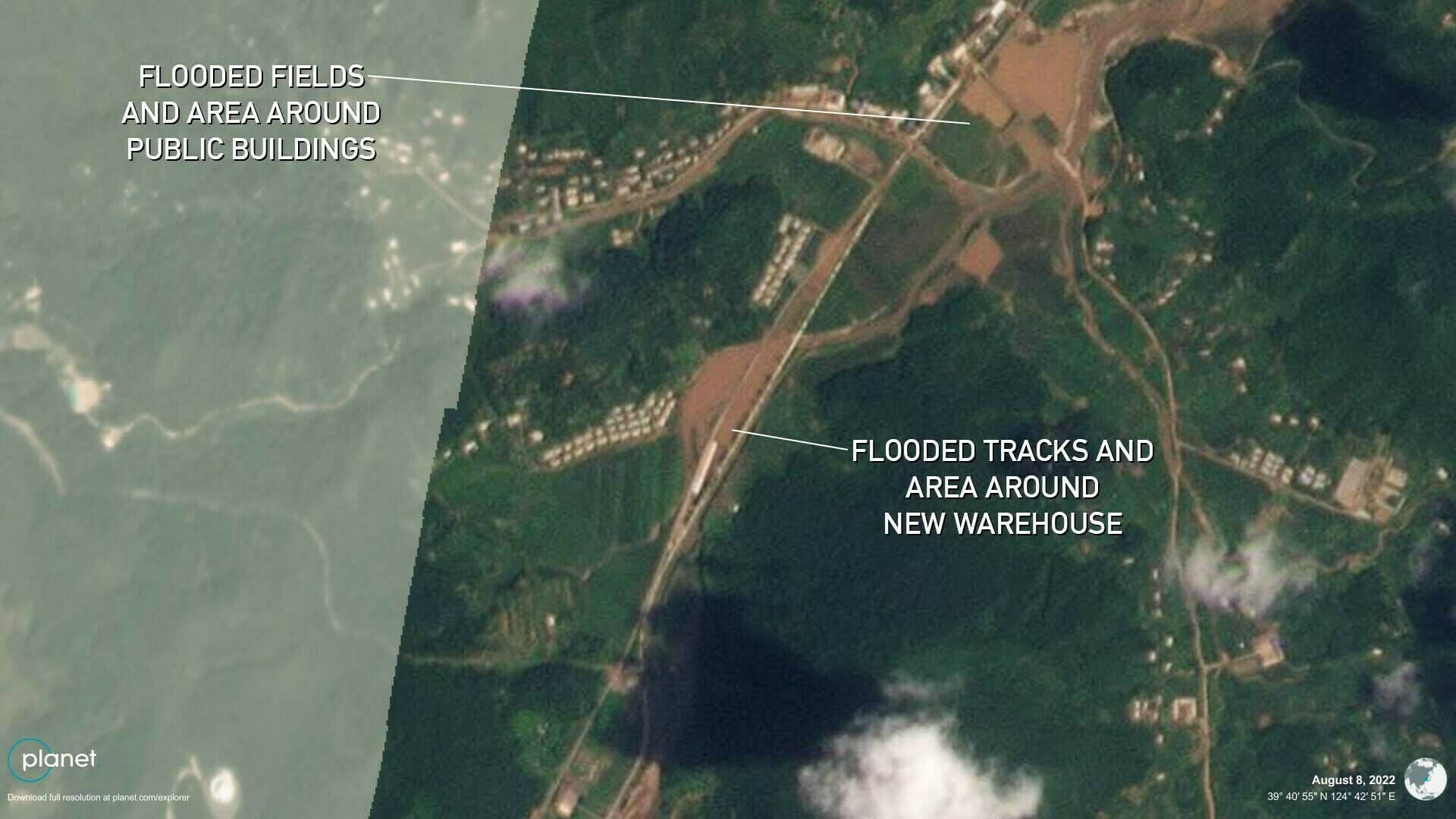 Flooding also appears to have affected homes, fields and public buildings to the north of the Sohae complex entrance | Images: Planet Labs PBH, edited by NK Pro Another road leading to an adjacent group of a few dozen small homes also appeared flooded, in addition to public buildings and agricultural fields nearby to the north. The construction worker camp and some small existing homes in the seaside Janggang village appear to have been partially submerged as well, creating potential problems for the project’s planning and execution. There is also evidence of a possible landslide at the southern end of the village. 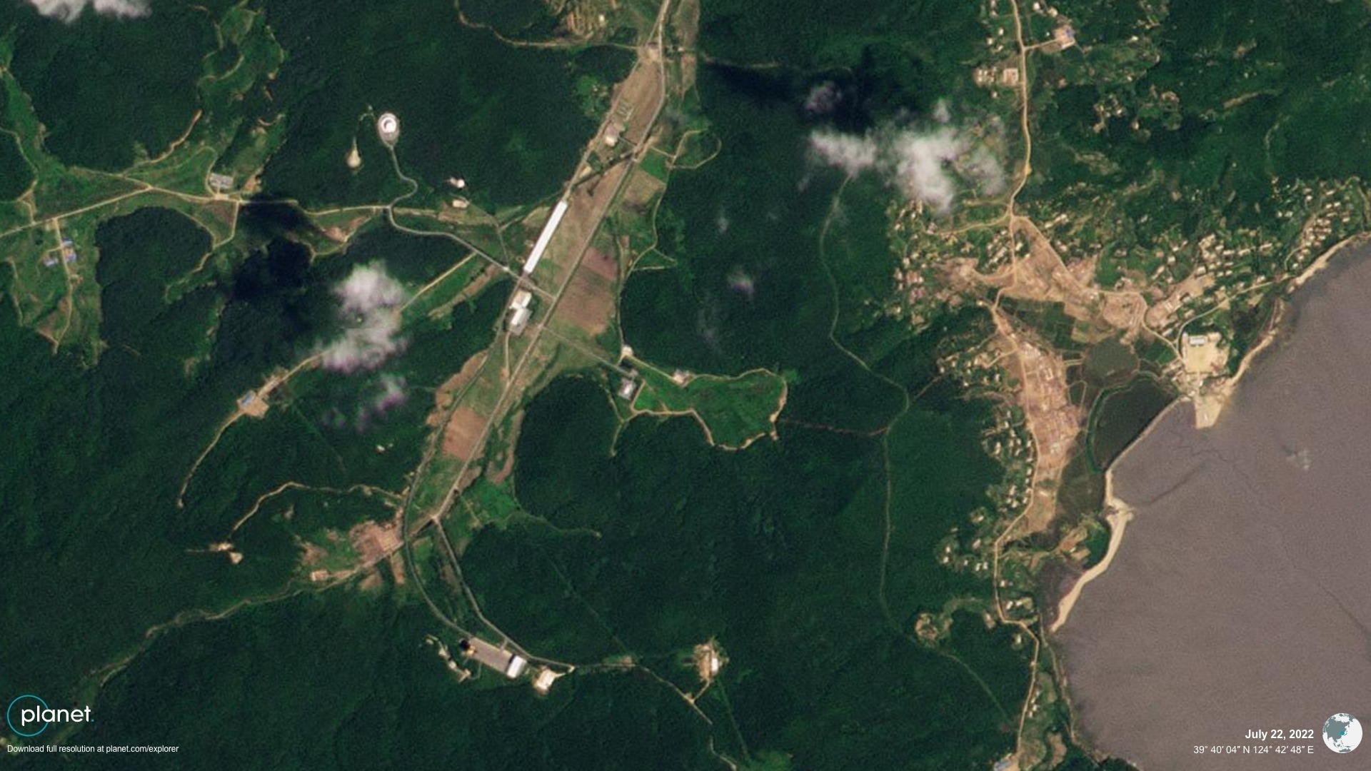 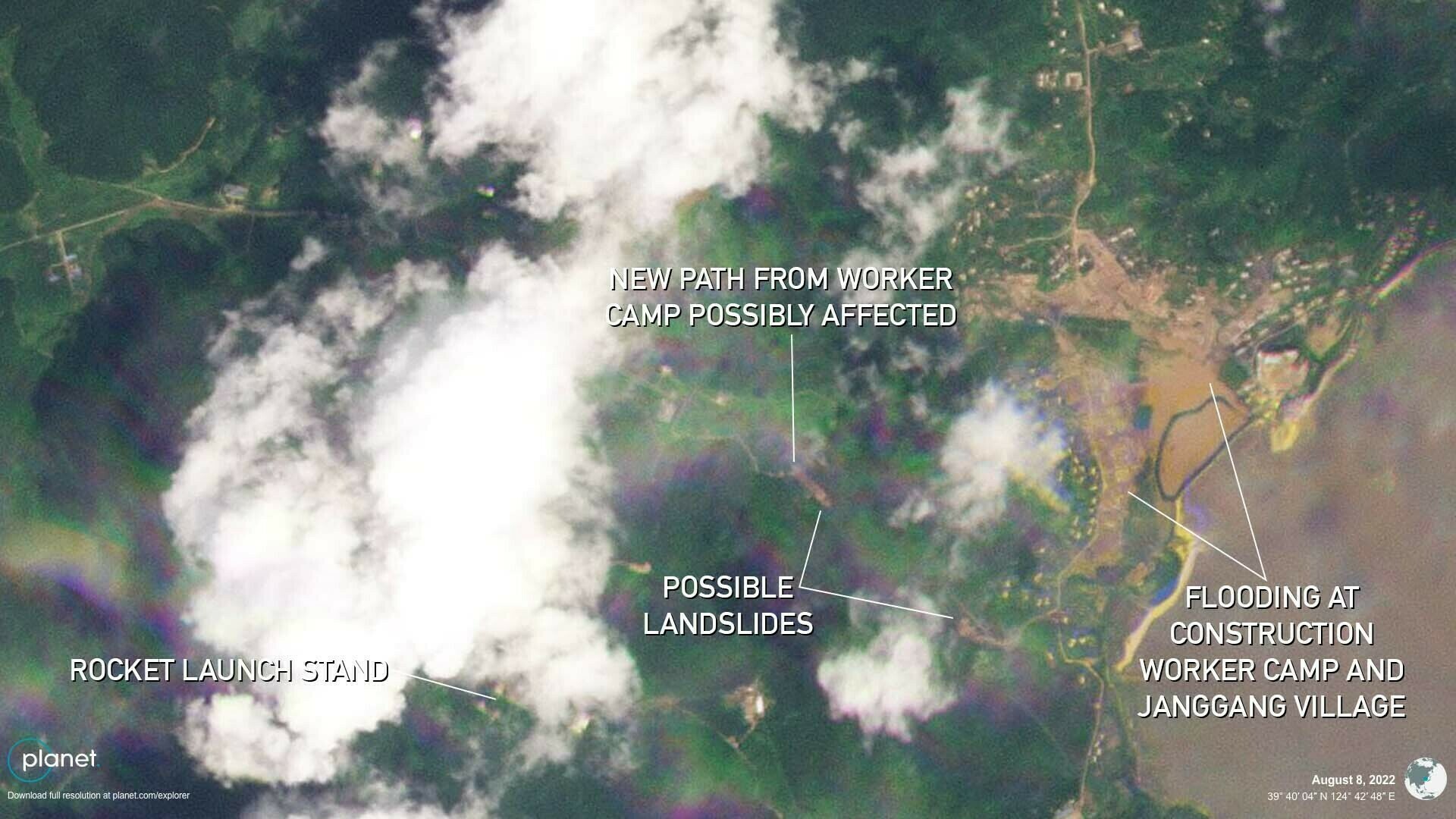 Before and after heavy rains on Aug. 7, which appear to have affected the construction worker camp established in mid-June in Janggang village, east of the Sohae complex | Images: Planet Labs PBH, edited by NK Pro Another landslide appears to have occurred at the Sohae rocket engine vertical test stand, leading from below a steep mountainside road that leads to a VIP observation building down toward the area under the test stand. It does not appear to have affected the test facilities themselves. Prior to the weekend’s storms, workers appeared to carve a new, wide road or path through the forest surrounding the vertical engine test stand and over an adjacent mountain toward Janggang village to the east in multiple stages between July 2 and Aug. 2. It may be for workers coming from the construction worker camp, similar to one built earlier to the north, or it could serve as a new security perimeter given its location and large width resembling other security perimeters in the country. The path did not appear to be finished as of Aug. 8.  KCTV said Monday evening that rainfall totals in South Phyongan Province subsequently exceeded those in North Phyongan which caused the flooding detailed above, meaning additional areas may later be revealed to have suffered damages. The state TV report said nearby Kwaksan County to the east received 14 inches (356 mm) of rain on Monday alone, and that as of 7 p.m. that evening an average of 7.5 inches (192 mm) fell since Sunday across South Phyongan Province, 6.3 inches (160 mm) across North Phyongan, 5 inches (127 mm) across the city of Kaesong near the inter-Korean border, 4.3 inches (111 mm) across North Hwanghae and 4.1 inches (105 mm) across the capital Pyongyang. Planet Labs imagery from Monday shows major flooding of agricultural fields surrounding Kwaksan. State media on Tuesday encouraged farmers to take proper steps to protect crops from severe weather. 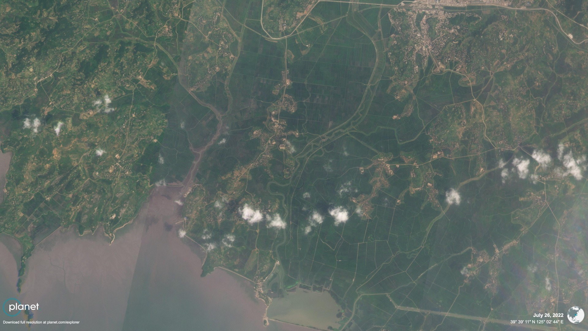 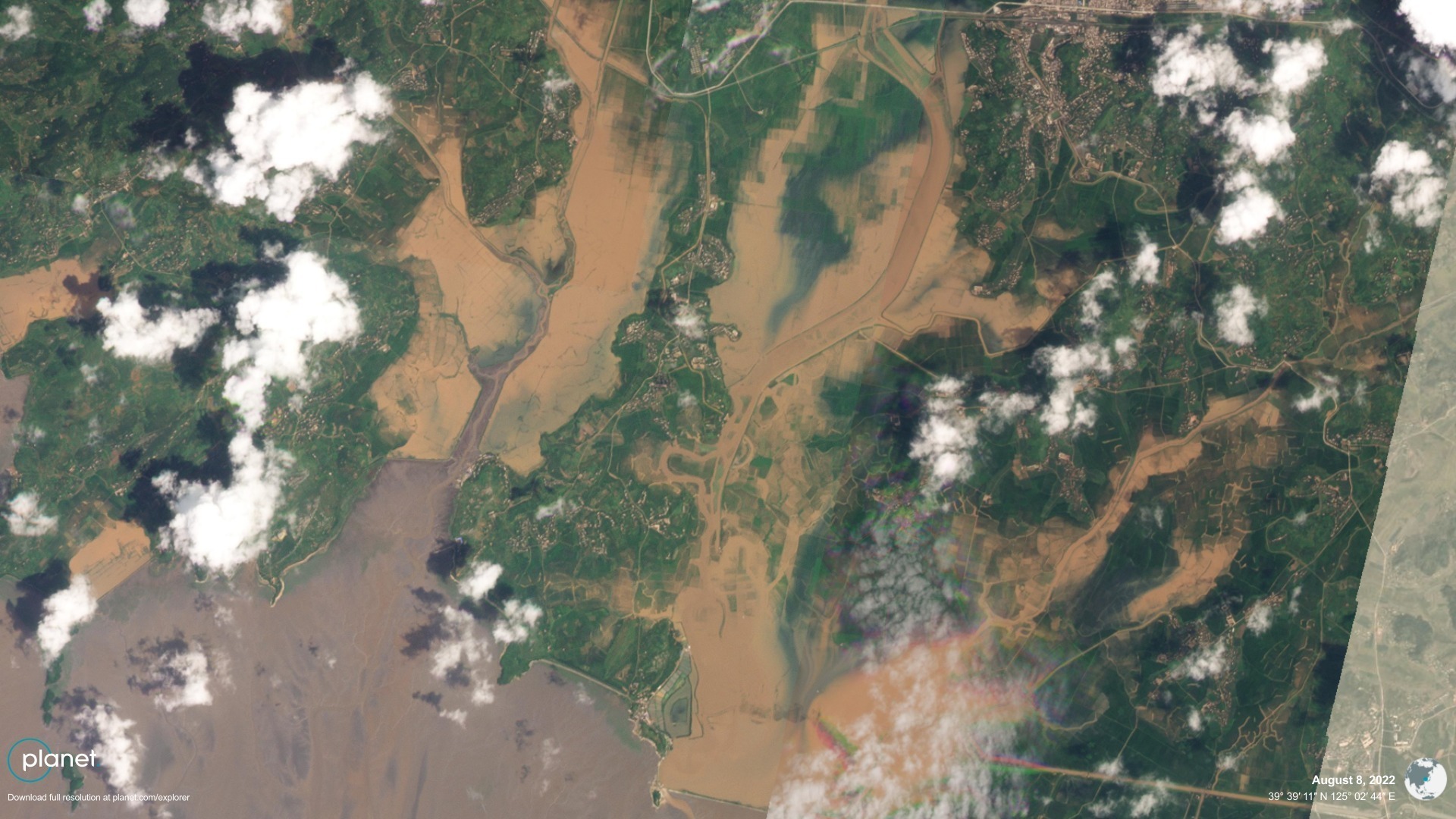 Agricultural fields appeared to be heavily flooded in Aug. 8 imagery of Kwaksan County, located about 18 miles (30 km) to the east of the Sohae complex | Images: Planet Labs PBH, edited by NK Pro More rain averaging up to around 4 inches (100 mm) was forecast for Tuesday in the inter-Korean border region affecting the DPRK cities of Haeju and Kaesong, according to KCTV. The north of the country, including the Sohae spaceport area, was forecast to be clear on Tuesday. Meanwhile, the DPRK Supreme People’s Assembly Standing Committee reportedly enacted changes to the country’s Law on Aerospace Development on Sunday to help move toward Kim’s near-term goal of launching military reconnaissance satellites. Edited by Arius Derr © Korea Risk Group. All rights reserved. |

October 06, 2026Oct 06, 2026

The ultimate resources for professionals working on North Korea
 SHARE
SHARE COPY LINK
 X
X MASTODON