  News Imagery reveals near-constant activity at North Korean coal terminal in OctoberPlanet imagery taken almost every day shows regular traffic despite sanctions 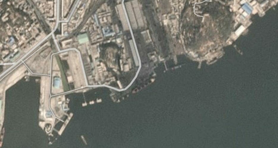 Satellite imagery from Planet Labs collected at nearly-daily intervals in October shows continued activity at North Korea’s coal loading pier in Nampho on the country’s western coast. With cloudy weather conditions often obscuring satellite photographs of the Korean peninsula over the summer months, more recent images show vessels at the coal terminal every day. The Nampho terminal is one of the North’s primary loading areas for coal, which before the current sanctions regime would usually be designated for legitimate export to neighboring China. Since the UN issued restrictions or bans on the North’s raw material trades, however, the Nampho port area has become a hotbed for the North’s illicit imports and exports. “A Member State provided imagery of certain DPRK ports, in particular, Nampho, as hubs for suspected illegal activity,” the UN Panel of Experts (PoE) wrote in their first report of 2019, in addition to “imagery highlighting the consistent use of Nampho port for loading prohibited exports of DPRK coal.” Although it’s possible that the DPRK also loads coal at Nampho for transport around the Korean peninsula, it remains possible that many of the vessels captured by Planet could also go on to deliver the coal to foreign buyers in breach of UN resolutions. Planet Labs satellites captured images on the area on most days throughout the first half of October, while only two days (October 1 and October 6) were obscured by cloud cover. Nearly all the images captured in the first two weeks of the month show vessels at the Nampho facility, indicating continuing traffic to the region. The ships are also usually pictured with their cargo holds open, a sign that some type of loading is occurring, though satellite imagery does not conclusively prove that the ships are loading coal. In the latest image taken on Tuesday, one large vessel and another smaller ship are docked in area, while a photo taken on the previous day shows two smaller vessels measuring around 80 meters both appearing to be using the Nampho port facility. Imagery taken on October 13 again shows one much larger vessel docked at the loading pier, while one of the smaller vessels appears to have remained at the dock for over 24 hours. The Planet Labs photo taken on October 8 is the only image over the two-week period in which no ships are docked at the coal port, while other images taken on October 3, 4, and 5 all show vessels using the facility. Although satellite imagery does not provide information on the direction of the trade or a ship’s eventual destination, previous NK Pro reports have tracked an uptick in DPRK vessel visits to Chinese coastal waters.  In their latest report, the UN Panel of Experts also noted how DPRK affiliated ships seemed to be loitering near Shanghai, while the NK Pro ship tracker also indicates an uptick in North Korean vessel traffic in the region. According to the PoE, the DPRK’s coal smugglers also head to waters near the Chinese and Vietnamese coasts, an area called the Gulf of Tonkin. The NK Pro ship tracker also shows regular traffic near or through the region, though ships typically seem to disappear from commercial tracking systems as they approach the area. Edited by James Fretwell and Oliver Hotham Featured image: Planet Labs © Korea Risk Group. All rights reserved. |

October 08, 2026Oct 08, 2026

The ultimate resources for professionals working on North Korea
 SHARE
SHARE COPY LINK
 X
X MASTODON