|
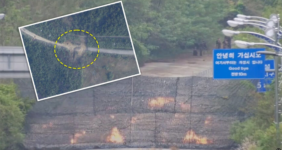
Analysis Satellite imagery shows DPRK laid explosives at edge of MDL to destroy roadsImages show North Korea is still in process of digging up sections of road and railways to sever ties to South  NK Pro has acquired the first satellite images of the road explosion North Korea carried out Tuesday as part of efforts to cut ties with South Korea, revealing that the DPRK military laid explosives right on the ROK border. Planet Labs high-resolution satellite imagery shows North Korea blew up and dug up parallel sections of road and rail starting from the edge of the military demarcation line (MDL) inside the demilitarized zone (DMZ) separating the two Koreas near Kaesong on the west coast. The image, taken early on Thursday morning, shows North Korea had removed © Korea Risk Group. All rights reserved. |

The ultimate resources for professionals working on North Korea


